
Kentucky’s Top 5 Weather Events of 2025
From floods to drought, from winter storms and severe storms, 2025 delivered more than its share of significant, memorable weather to the Commonwealth. Below is a list comprised by staff at the Kentucky Climate Center of some of the year’s biggest events, listed chronologically.
Jan. 5th-6th Messy Mixture of Snow, Sleet, Freezing Rain, and Rain.
A potent wave of low pressure moved into the lower Ohio Valley early on the morning of Jan. 5th. Moisture overrunning cold, arctic air at the surface resulted in a potpourri of precipitation. Heavy snow fell across portions of north-central Kentucky into the Blue Grass region. Louisville officially saw 10.5” of snow, with 9” of it falling on the 5th (a daily record and the third-snowiest calendar day ever for the city). Elsewhere, Covington picked up 10.6” of snow, while Lexington received 6.8”. Significant icing also occurred across parts of central and southern Kentucky. Ice accretion of over ¼” weighed down trees and power lines, resulting in numerous power outages as well as hazardous travel.
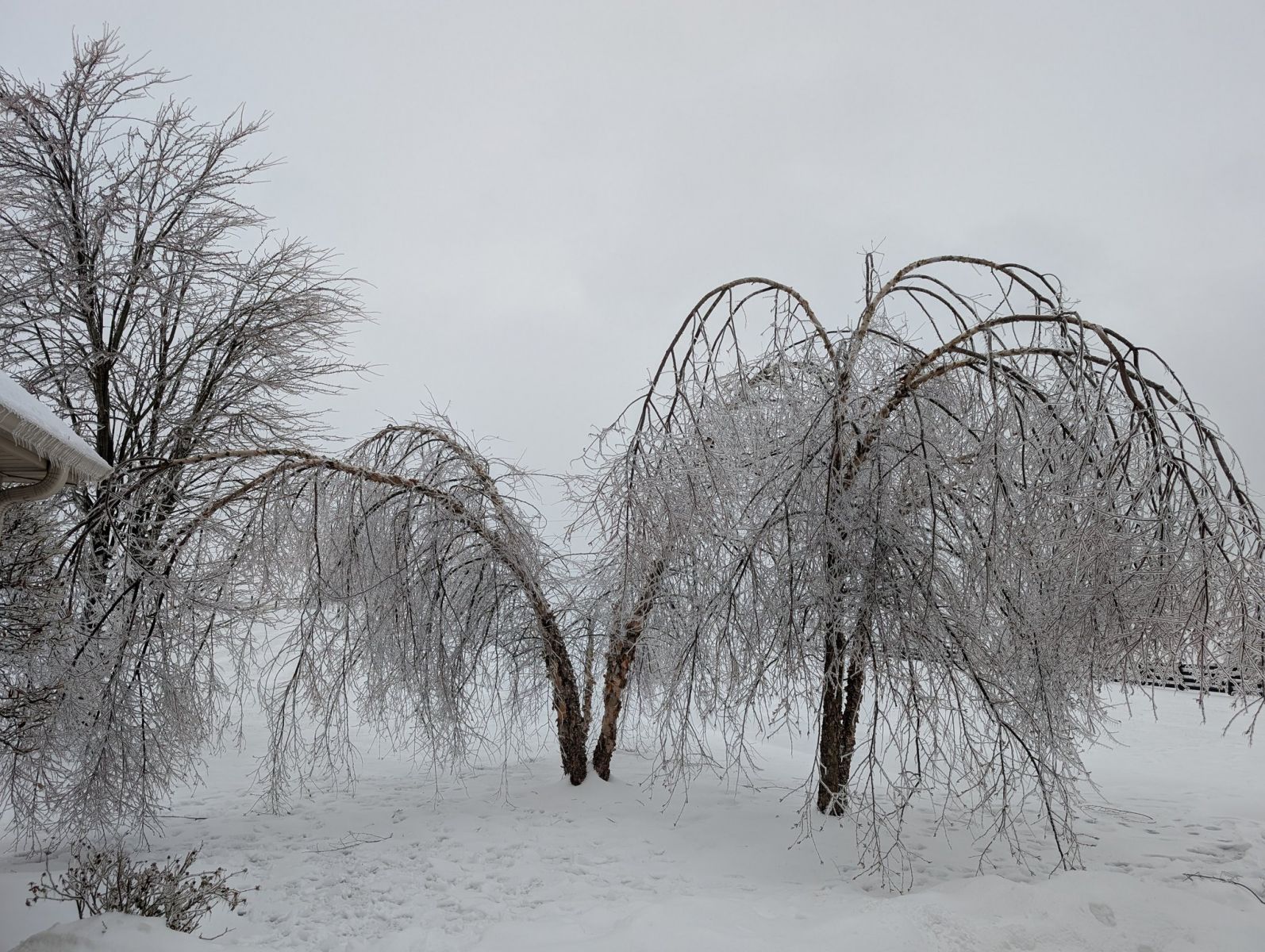 (Mercer County, January 2025. Photo courtesy NWS Louisville)
February 15th – 16th Flooding.
A frontal system stalled over southern Kentucky on the morning of Feb. 15th. This front served as the focal point for widespread showers and thunderstorms. Torrential rainfall fell across much of the state. Amounts ranged from 2-6” for most, with the highest totals noted across the western region. Significant flash flooding, areal flooding, and river flooding occurred. Cold, arctic air dropped into Kentucky on the morning of the 16th, resulting in some snow along with a ‘flash freeze’ as the system departed. Some two dozen fatalities were blamed on the storm system, with numerous schools, businesses and roads closed for a time.
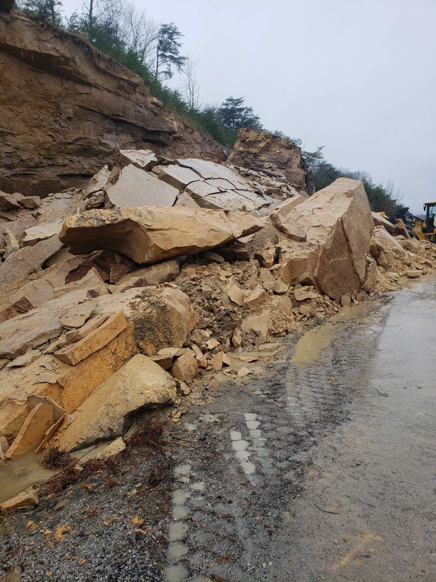 (I-69 rockslide near Dawson Springs, February 2025. Photo courtesy NWS Paducah)
Early April Flooding and Severe Weather.
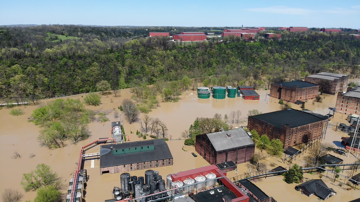
On April 2nd, a cold front eased into Kentucky. This boundary became stationary, meandering over the state for several days. Waves of rain and thunderstorms moved over Kentucky between the 2nd and the 6th. By the time the system finally exited on the morning of the 7th, upwards of 10” of rain had accumulated over a four-to-five-day span in numerous counties across the central and western regions. The KY Mesonet station in Marshall County near Benton received the highest rainfall total between the 2nd and the 6th of 15.86”, setting a multi-day rainfall record. Flash flooding, areal flooding, and river flooding were all common. The Kentucky River in Frankfort crested at 48.3’, its second-highest crest all-time there, while upstream at Camp Nelson, a record crest of 47’ was measured. Numerous gages along the Green River measured crests that ranked among the highest ever recorded at each location. Several fatalities were blamed on the flooding, with numerous road closures as well as businesses and schools shut down for a time. In addition to the heavy rains, this system also produced rounds of severe thunderstorms with several tornadoes. The strongest tornado touched down in Jeffersontown, a suburb of Louisville, where an EF-3 with winds to 145 mph was confirmed on the 2nd.
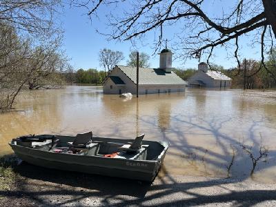 (Henry County flooding, April 2025. Photo courtesy NWS Louisville)
May 16th Severe Weather Outbreak.
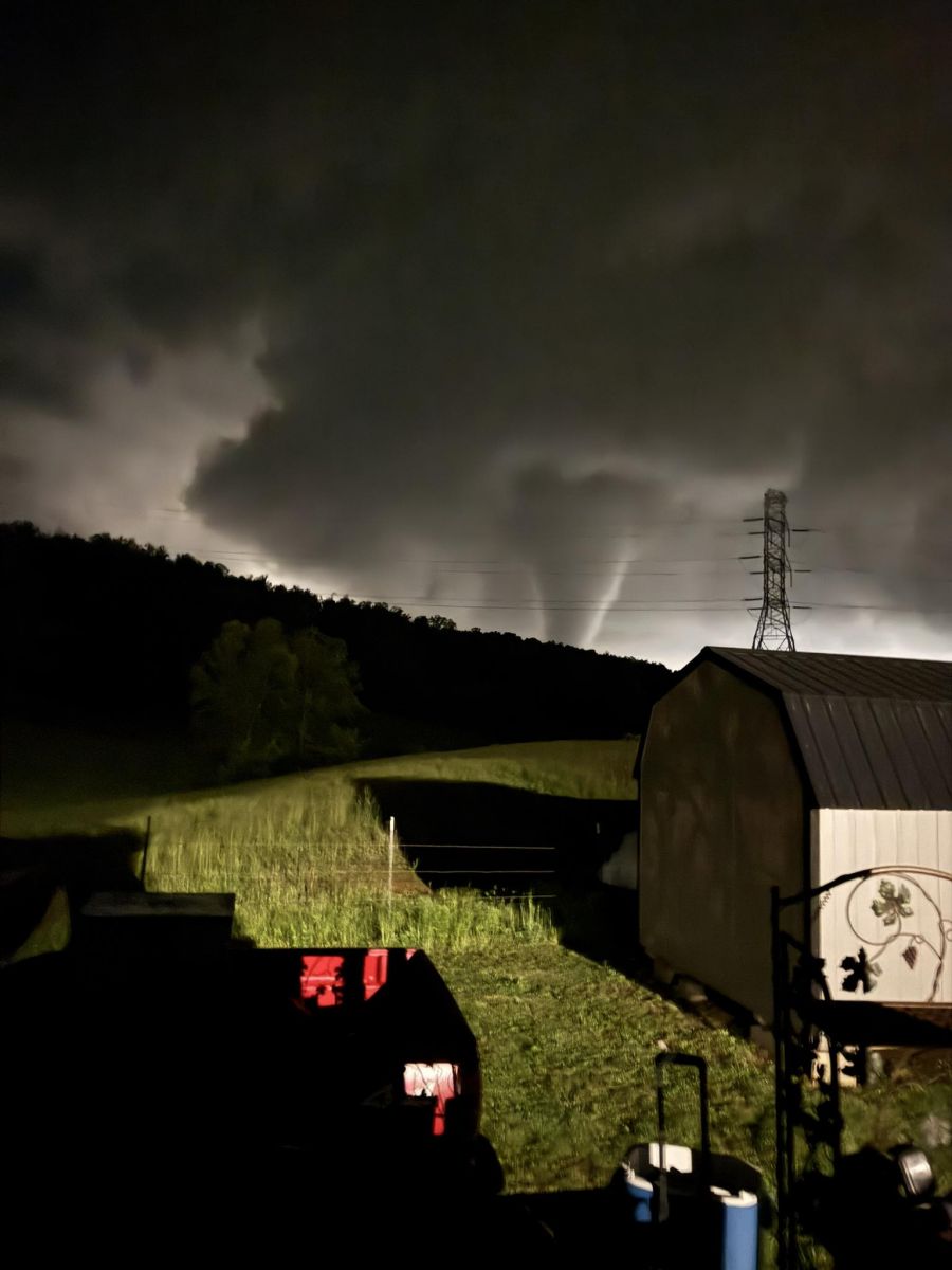
Spring was stormy, but the season’s most prolific severe-storm producer blew through the Commonwealth in mid-May. Thunderstorms brought damaging winds and large hail to some. A wind gust to 82 mph was clocked the Muhammed Ali International Airport in Louisville. However, the most notable event from this outbreak was the violent, long-tracked tornado that carved a 60-mile-long path through Russell, Pulaski, and Laurel Counties late on the night on the 16th. Some of the most significant damage occurred on the south side of London, KY. This tornado took 19 lives and was rated EF-4 with winds as high as 170 mph. This was the strongest tornado to strike the state’s mountainous eastern region since April 3, 1974.
 (May 16, 2025 Eastern KY tornado. Photo courtesy NWS Jackson)
Record Dry August Leads to Late Summer/Early Autumn Drought.
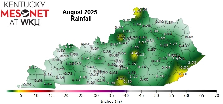
August 2025 was the state’s driest August, dating back to 1895, with an average rainfall of only 1.29”. Many locations failed to receive one-quarter inch of rain for the month. The KY Mesonet site near Hardinsburg in Breckinridge County went the entire month without measuring a drop of rainfall. The persistence of abnormally dry conditions led to the development of drought for a 4th-straight year in Kentucky. The drought reached its peak in September. At one point, roughly 68% of the Commonwealth was classified as being officially in drought per the National Integrated Drought Information System (NIDIS). A small section of the western region even slipped into ‘Extreme Drought’ (D3 classification) in September before significant rains returned to the state.
© 2026 Copyright Kentucky Climate Center
Back To Top